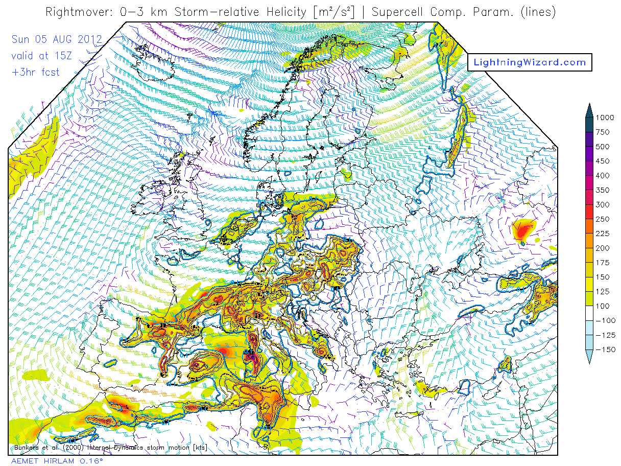
"A level 1 was issued for NE France, Benelux and W/ NW Germany mainly for severe wind gusts, marginally large hail and tornadoes.
DISCUSSION
...NE France, Benelux, W Germany...
Recent outputs of GFS and also recent soundings indicate that there will be a good overlap of 20 - 25 m/s deep layer shear and some hundred J/kg CAPE. As the shortwave trough approaches during the afternoon hours, QG forcing should be sufficient for convective initiation. Given some locally augmented SRH3, some storms may become supercellular and may pose a threat of marginally severe hail, severe wind gusts and tornadoes. The threat of severe weather will gradually diminish after sunset as most of the CAPE is confined to the boundary layer. "
Although I don't have the 'prove' of Doppler- radardata, I dare to conclude that a few supercells showed up; the most impressive also visiting the Rotterdam- area. In 'Putten' a short tornado was reported. When the radar showed a persistent cell approaching my living- area I went out and stayed eastward of the cell. I was not able to catch the sometimes very agressive look of the updraft area very well on photo, but I gladly place some pictures to give an impression of this supercell- event. While I was in the warm, pressing, moist inflow area, my family at home had very intensive rain. Hail with a diameter of more than 2 cm was reported as well.
By times a wallcloud formed, but most impressive were the pieces of 'fractus' almost hanging on the ground. The inflow- area at times looking extremely and almost scarying agressive....
To stay 'safe' and ahead of the NE going inflow- area I had to drive along villages near the A15 to Gorinchem.


Angry sky coming by ............I rather fast had to go more eastward

Sliedrecht @ 'Sliedrecht'

The wall didn't show up on the navigating- system......